India /
Himachal Pradesh /
Solon /


Solan
World / India / Himachal Pradesh / Solon World / India / Himachal Pradesh / Solan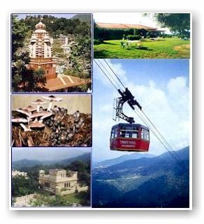

Tehsil Solan, District Solan, Himachal Pradesh, Bharat
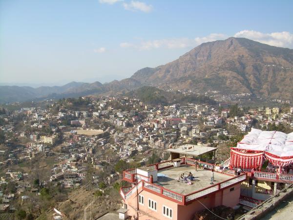
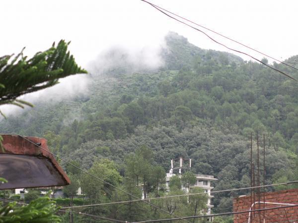
Solan is a city and a municipal committee in Solan district in the Indian state of Himachal Pradesh. Solan is the district headquarters of Solan district (created on 1 September 1972)
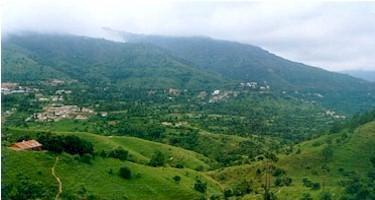
Not many years ago this scenic hill station was the fastest growing town in Asia, with the greatest vehicle density in India. It is surrounded by numerous natural spots that have formed the perfect backdrop for not only film and music video shoots, but also for giving a treat to the tourists' eyes. This town is an amazing mix of advancement on the technological front and natural beauty. It also boasts of many firsts: Dr. Y.S. Parmar University of Horticulture and Forestry, the Mushroom Research Center, A state of the art Forensic Science Lab, the Potato Research Center, Zoological Survey of India's Northern Office and many more.
Solan boosts of a mushrooming mushroom and tomato business.Wood availability is ample. Farmers should be a happy lot.
Lot of reputed companies like HFCL have their presence. The district boosts of a mix of divisions with varied popularity , Parwanoo is a good hunting groud for companies and job seekers, kasauli is a poplular hill station and cantt - surrounded with huge pine and deedar trees , chail is popular for its palace and the highest cricket ground.
This place also exhibits a variety of cultures , paharis and punjabis the major lot. The culture comes in its full bloom during the summer mela , which is very popular in this region !
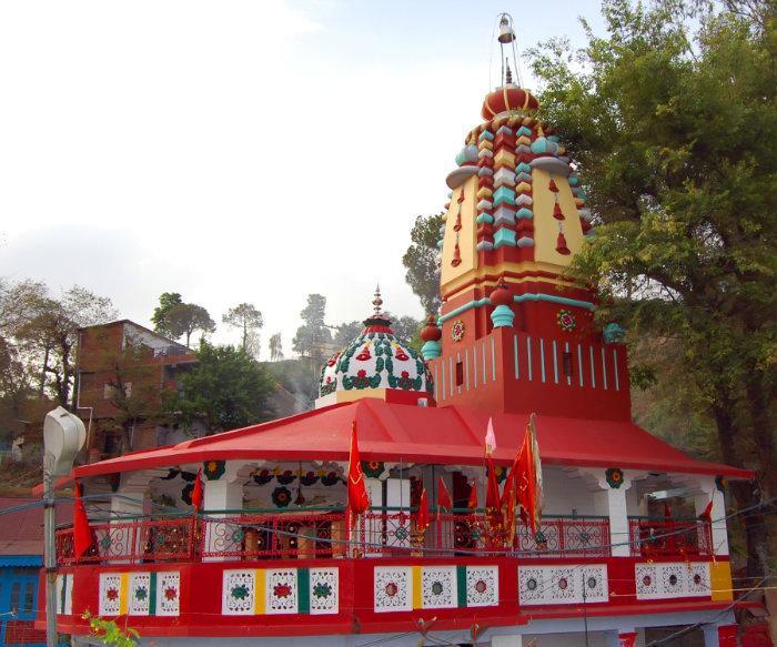
Solan is named after goddess "Shoolini". Besides the Dr. Yashwant Singh Parmar University of Horticulture and Forestry at Nauni, other places of interest in Solan include the Shoolini Mata temple (Solan is named after the goddess Shoolini), the Jatoli Shiv temple and the Yungdrung Tibetan Monastery, also near Nauni.
There is also a three hundred year old Ghurka fort at Nauni, which dates back to the time when the region was ruled by the Ghurka rulers Nepal. The fort is in ruins, but it is strategically located atop a mountain point providing a panaromic view of the entire area.
See wikipedia article for more details.
Solan is a city and a municipal committee in Solan district in the Indian state of Himachal Pradesh. Solan is the district headquarters of Solan district (created on 1 September 1972)
Not many years ago this scenic hill station was the fastest growing town in Asia, with the greatest vehicle density in India. It is surrounded by numerous natural spots that have formed the perfect backdrop for not only film and music video shoots, but also for giving a treat to the tourists' eyes. This town is an amazing mix of advancement on the technological front and natural beauty. It also boasts of many firsts: Dr. Y.S. Parmar University of Horticulture and Forestry, the Mushroom Research Center, A state of the art Forensic Science Lab, the Potato Research Center, Zoological Survey of India's Northern Office and many more.
Solan boosts of a mushrooming mushroom and tomato business.Wood availability is ample. Farmers should be a happy lot.
Lot of reputed companies like HFCL have their presence. The district boosts of a mix of divisions with varied popularity , Parwanoo is a good hunting groud for companies and job seekers, kasauli is a poplular hill station and cantt - surrounded with huge pine and deedar trees , chail is popular for its palace and the highest cricket ground.
This place also exhibits a variety of cultures , paharis and punjabis the major lot. The culture comes in its full bloom during the summer mela , which is very popular in this region !
Solan is named after goddess "Shoolini". Besides the Dr. Yashwant Singh Parmar University of Horticulture and Forestry at Nauni, other places of interest in Solan include the Shoolini Mata temple (Solan is named after the goddess Shoolini), the Jatoli Shiv temple and the Yungdrung Tibetan Monastery, also near Nauni.
There is also a three hundred year old Ghurka fort at Nauni, which dates back to the time when the region was ruled by the Ghurka rulers Nepal. The fort is in ruins, but it is strategically located atop a mountain point providing a panaromic view of the entire area.
See wikipedia article for more details.
valleytowntaluka headquarterdistrict headquarter
Wikipedia article: http://en.wikipedia.org/wiki/Solan
Nearby cities:
Coordinates: 30°54'18"N 77°5'57"E
- Paldar Valley (padder) 298 km
- Zanskar Valley 321 km
- Warwan Valley 395 km
- Suru Valley 415 km
- Gurez Valley 479 km
- Kashmir Valley 499 km
- Bagrote Valley 633 km
- Shaksgam Valley 643 km
- Waygale Valley 760 km
- Panjshir Valley 904 km
- Housing Board Colony 0.6 km
- St. Lukes Senior Secondary School 1.3 km
- Village Bajrol 1.6 km
- N.R.C.M. CHAMBAGHAT, SOLAN 1.9 km
- New Kather 1.9 km
- Sand Quarry 2.5 km
- Jarash 2.9 km
- Solan Brewery(Mohan Meakin Ltd. head Office) 3.1 km
- Karol Ground.. Near Budda Gwal.... 3.5 km
- Tikker 3.8 km
Comments