Netherlands /
Noord-Brabant /
Landerd /


Volkel Air Force Base (ICAO: EHVK / IATA:UDE)
World / Netherlands / Noord-Brabant / Landerd World / Netherlands / Noord-Brabant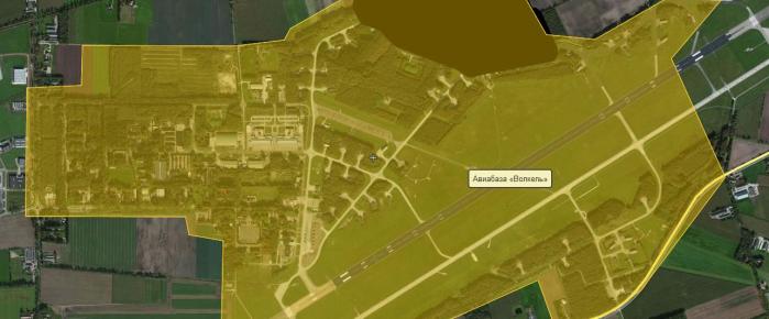
Volkel Air Force Base (Dutch: Vliegbasis Volkel) is a military airfield used by the Royal Netherlands Air Force (RNAF). One of the three F-16 bases of the country, Volkel houses four squadrons: 306sq, 311sq, 312sq and 313sq. So this base is quite a busy place. It also serves as a maintenance and logistical base for the RNAF and houses the 703d Munition Support Squadron, part of the 52d Fighter Wing from the United States Air Force Europe. A lot of military visitors are coming there as well. And there are two nice places on both sides of the runway to watch planes.
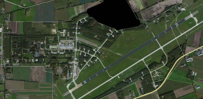
In a book published by former air force pilot Steve Netto it is revealed that some fifty B28 nuclear bombs were in storage there around the time of the Cuban Missile Crisis, which if needed were to be deployed by aircraft of the Royal Netherlands Air Force. In a document leaked as a part of the United States diplomatic cables leak the presence of nuclear weapons in the Netherlands is confirmed, though no specific location is given.On 10 June 2013, former prime minister Ruud Lubbers confirmed the existence of 22 nuclear weapons at the airfield.There are suspicious blackouts of the supposed location of the weapons on Google Maps and Yahoo Maps.
bit.ly/1y5RYu0
The blackouts of the supposed location of the weapons is made visible at maps.yandex.ru/
Rwy 06R/24L, 06L/24R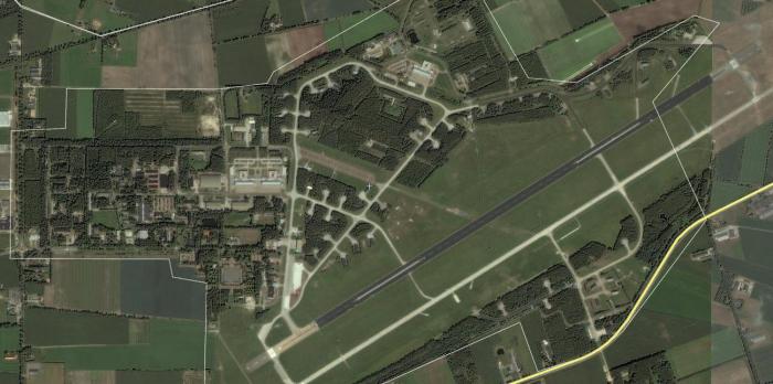
military airbasemilitary
Wikipedia article: http://en.wikipedia.org/wiki/Volkel_Air_Base
Nearby cities:
Coordinates: 51°39'27"N 5°42'5"E
- De Peel Air Force Base (ICAO: EHDP) 16 km
- Deelen Air Base (ICAO: EHDL) 48 km
- Firing Range "Mike" 56 km
- Infanterie Schietkamp (ISK) 57 km
- NATO Air Base Teveren Geilenkirchen 79 km
- Artillerie Schietkamp (opstelgebied) 83 km
- Artillerie Schietkamp (doelengebied) 89 km
- Norvenich Air Base 112 km
- Nordhorn Range 132 km
- Former RAF Gütersloh Now Princess Royal Barracks 181 km
- Uden (municipality) 3.2 km
- Mill en Sint Hubert 5.4 km
- Boekel (municipality) 5.8 km
- Landerd 6.5 km
- Grave (municipality) 10 km
- Veghel (municipality) 11 km
- Sint Anthonis (municipality) 11 km
- Cuijk (municipality) 13 km
- Oss (Municipality) 18 km
- North Brabant 43 km
Comments