Caroní Swamp
Trinidad and Tobago /
Chaguanas /
World
/ Trinidad and Tobago
/ Chaguanas
/ Chaguanas
World / Trinidad and Tobago
green area
Add category
Swamp and Bird Sanctuary.
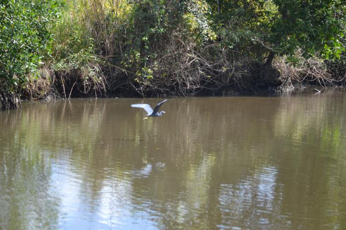
The Caroni Swamp is the largest mangrove wetland in Trinidad and Tobago. It is located on the west coast of Trinidad, south of Port of Spain and northwest of Chaguanas, where the Caroni River meets the Gulf of Paria.
The Caroni Swamp is an important tourist attraction and provides important habitat for the Scarlet Ibis (Eudocimus ruber), one of the national birds of Trinidad and Tobago.
The Caroni river is anmed for the Caroní river in Venezuela
Nearby cities:
Coordinates: 10°34'4"N 61°27'43"W
- BARATARIA FOOD GARDENS 8.7 km
- Queen's Park Savanah 13 km
- Aripo Savannas 29 km
- Forest 29 km
- San Pedro Forest Reserve 33 km
- Nariva Wildlife Sanctuary 39 km
- Trinity Hills Game Sanctuary 51 km
- Tobago Plantations Golf and Country Club 99 km
- Durban Park 555 km
- Rabbit Kingdom 556 km
- Invaders Ground 3.6 km
- Felicity Hindu School 4 km
- Green Park Recreational Ground 4.2 km
- Madame Espagnoi river 4.5 km
- Jubilee Recreation Grounds 4.6 km
- Plot 53 4.8 km
- Sugar Cane :Loading Facility 6.5 km
- No 7 River 7.6 km
- Trinidad 15 km
- Gulf of Paria 78 km